Itinerary
- Day 1
Carnic High Trail Start
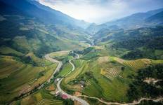
This morning you'll start your mountain adventure on the Carnic High Trail, heading past Austria's southernmost glacier. The path climbs steadily uphill through shaded sections toward Wolayersee hut, and the work pays off with impressive panoramic views of the lake once you arrive. It's a long and strenuous day, so pace yourself on the ascent and take breaks as needed.
- Meals
- Dinner
Included Activities
- Hike to Wolayerseehütte via Valentintörl and past Eiskar Glacier (approximately 4 hours, 7 km distance with approximately 1,150 m ascent and approximately 250 m descent)
- Optional geotrail in the nature reserve if time permits
Landmarks/POIs Eiskar Glacier Kellerspitzen Wolayersee - Day 2
Fleonstal Valley
You'll hike through the Fleonstal valley today, where things feel like they haven't changed much over time. After descending to Obere Wolayeralm, you'll pass through pastoral farmland and a cheese dairy before climbing to Öfner Joch. Here you'll come across World War I history remnants, then finish with a short descent down to Hochweisssteinhaus.
- Meals
- Breakfast, Dinner
Included Activities
- Hike through Fleonstal valley via Obere Wolayeralm, Giramondo Pass, Lago Pera, and Öfner Joch to Hochweisssteinhaus (approximately 6 hours, 14 km distance with approximately 900 m ascent and approximately 1,000 m descent)
- Visit cheese dairy and farm in the valley
- Explore World War I ruins along the ascent to Öfner Joch
Landmarks/POIs Fleonstal Biegengebirge Lago Pera Öfner Joch - Day 3
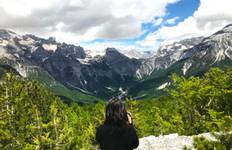
Ridge Walk with Carnic Alps Views
The views along the Carnic ridge today are really something special. Early on you'll descend to Ingridalm, then take the traversing mountain path to Luggauer Törl (this route is available in August when conditions are clear). From there the trail goes steadily up and down before following the ridge to Porzehütte, where you get some of the best panoramic scenery on the entire trek.
- Meals
- Breakfast, Dinner
Included Activities
- Ridge hike from Hochweisssteinhaus via Ingridalm and Luggauer Törl to Porzehütte (approximately 9 hours, 18 km distance with approximately 1,400 m ascent and approximately 1,300 m descent)
- Optional traversing mountain path route to Luggauer Törl (available in August when clear)
Landmarks/POIs Ingridalm Luggauer Törl - Day 4
Pfannspitze Peak
Today you'll reach the highest point of the Carnic High Trail at Pfannspitze, which sits at 2,678 meters. You'll ascend to Heretriegel first, cross through meadows to Filmoorhütte where you can rest and grab food, then climb to the peak. The route changes things up with varied terrain and great ridge views before you descend to Obstanserseehütte.
- Meals
- Breakfast, Dinner
Included Activities
- Hike from Porzehütte via Heretriegel, Filmoorhütte, and Pfannspitze (2,678 m) to Obstanserseehütte (approximately 5 hours, 12 km distance with approximately 1,250 m ascent and approximately 900 m descent)
- Optional climb of Kinigat above Filmoorhütte
Landmarks/POIs Heretriegel Filmoorhütte Pfannspitze Kinigat - Day 5
Sesto Dolomites Views
After the harder days behind you, this stage is shorter and easier while still giving you some of the best views of the Sesto Dolomites. You'll follow ridge paths across grassy hills, hiking from Obstanserseehütte back to the ridge and continuing toward Sillianuerhütte through rolling alpine meadows. The rolling terrain makes for a nice change of pace.
- Meals
- Breakfast, Dinner
Included Activities
- Hike from Obstanserseehütte via ridge paths to Sillianerhütte (approximately 4 hours, 9 km distance with approximately 600 m ascent and approximately 450 m descent)
Landmarks/POIs Sesto Dolomites - Day 6
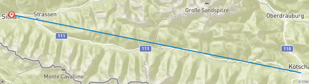
Descent to Vierschach
Your final day is mostly downhill as you descend from the mountains back to the valley. You have options here: climb to Helm first if you want one last panoramic mountain view, or skip that extra climb and head straight down. If you prefer something more relaxed, there's also a cable car from the top station that takes you into Vierschach.
- Meals
- Breakfast
Included Activities
- Descent from Sillianerhütte to Vierschach (approximately 4 hours, 8 km distance with approximately 1,400 m descent)
Optional Activities
- Optional hike to Helm for panoramic mountain views before descent
- Optional cable car ride from top station to Vierschach (alternative to walking the full descent)
Landmarks/POIs Helm Vierschach